


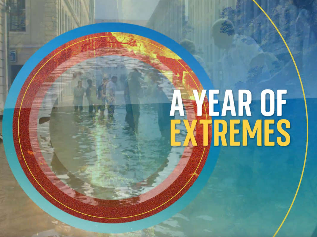
In the last 12 months, the planet has seen an extraordinary series of climatic events that have gone down in history.
From heatwaves to storms; floods to wildfires - if everyone had not been so focused on COVID, it would have been remembered as the year of extremes.
While it is still not possible to say that all of them are directly caused by climate change, increasing amounts of evidence say they wouldn't have been so extreme if the planet was not warming.
Here are some of them:

In the age when global warming is widely recognised, the lowest UK temperature of the millennium so far might seem an anomaly.
But the -23.0C (-9.4F) seen in Braemar, Aberdeenshire, in February was remarkable in that it had taken so long to occur.
The Met Office pointed out that, while it was low - the seventh lowest since accurate records began in 1961 - it came after a long period when temperatures had failed to dip as low as -20C (-4F) for more than 10 years.
Until the late 1980s, the mercury regularly plummeted that low. Even in the late noughties, temperatures were almost annually falling to -15C (5F) somewhere in the UK.
Dr Mark McCarthy, head of the National Climate Information Centre, said: "The UK's climate record displays a huge range of natural variation and even though our climate has warmed by approximately 1.0C, there is still the possibility of a severe cold weather event - they're just not as regular as they used to be."
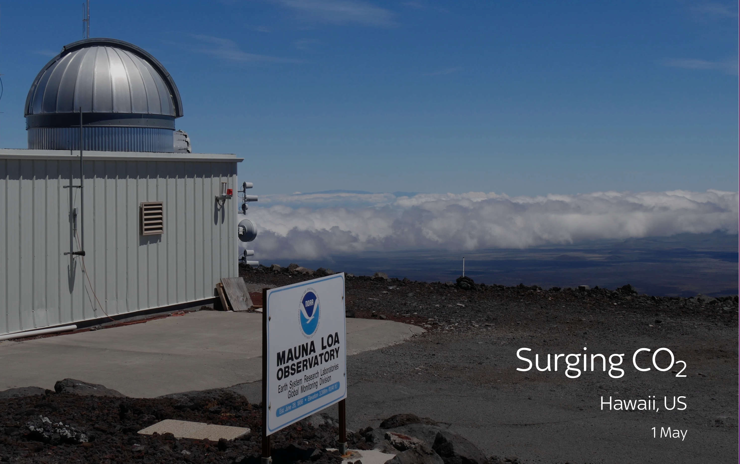
It was widely touted that the various lockdowns brought in around the world because of COVID would cause carbon dioxide emissions to go into reverse.
In May, despite everyone's hopes, it was confirmed that was not the case and atmospheric CO2, as measured at the Mauna Loa Observatory, Hawaii, was at record levels once again.
Apart from a brief period in the early 1990s, which coincided with a worldwide recession, CO2 has consistently risen since accurate records began in the 1960s. As CO2 has risen, so have global average temperatures.
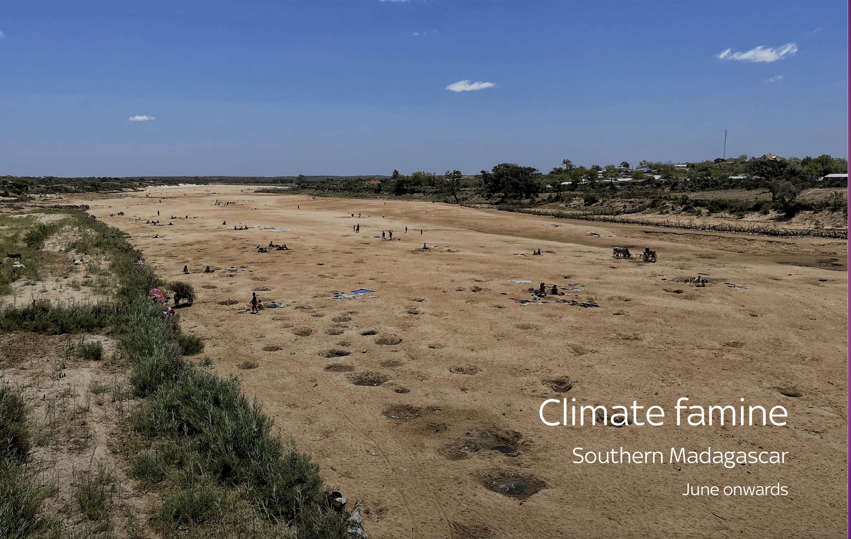
In June, the World Food Programme, which had been monitoring the situation in southern Madagascar for some time, said that the food emergency there was due to climate change.
A lack of rain over the 24 months from July 2019 to June 2021 was estimated as a 1-in-135 year dry event.
The crisis had got so bad that thousands of people were already living under something called IPC phase 5, which is defined as an official famine.
Tens of thousands more were said to be on the "brink" of famine.
Executive director David Beasley said: "This is not because of war or conflict, this is because of climate change."
A further report in December, by scientists from South Africa, Madagascar, New Zealand, India, Netherlands, France, the US and the UK, found that the famine was caused by a combination of factors, which included natural variation in the weather.
Nonetheless, the crisis highlights the impact of unpredictable weather on vulnerable communities, which the latest report said was among the main drivers of the area being hit, with a mix of poverty, farming practices as well as the actual weather being to blame.
The crisis remains ongoing into the winter, according to the US government's Famine Early Warning Systems Network, with crisis level "or worse outcomes... likely in some areas of southern Madagascar as the cassava production is expected to be near zero and households are overselling their livestock and productive assets to meet their food needs".
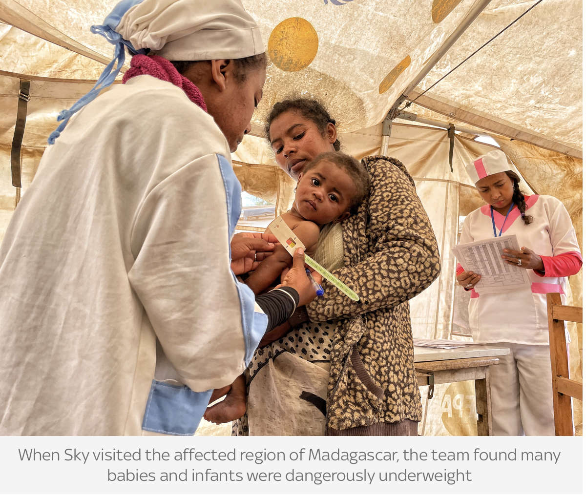
When Sky News visited the area in November, while COP26 was taking place in Glasgow, we found babies sick with hunger.
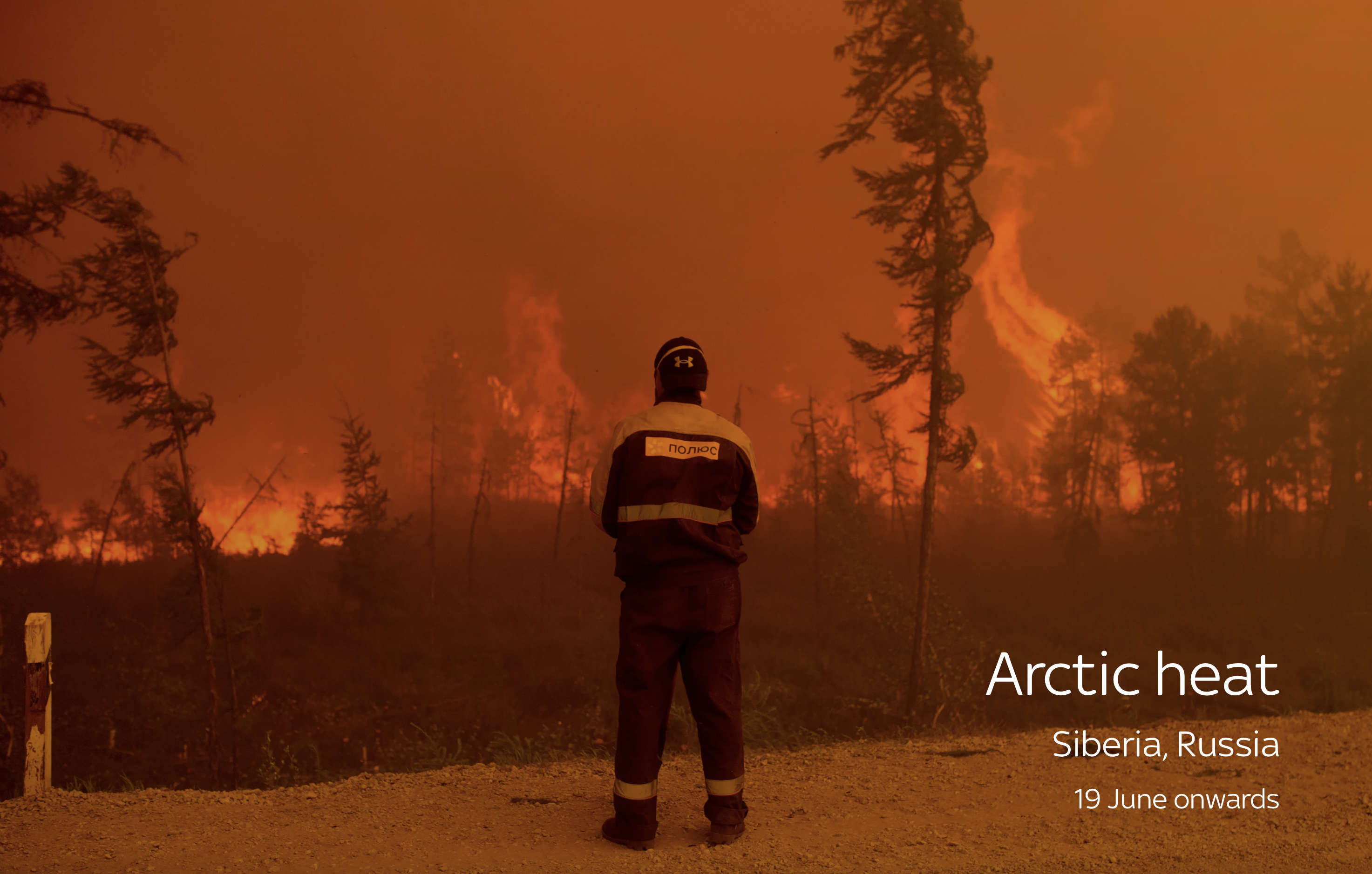
At 14 degrees below the North Pole, Russia's Kotelny Island - one of the most northerly land masses on the planet - rarely gets much above freezing, even in the height of summer.
On 20 June, amid a heatwave that struck the whole of the Russian Arctic region, temperatures in Kotelny reached 19.7C (67.5F) - something never before seen on the island ahead of the summer solstice.
Around the same time, normally chilly Moscow saw its high reach a level not seen since 1901 - 34.7 degrees Celsius (94.5F) - and St Petersburg saw its hottest ever day in June on the 23rd, at 35.9C (96.6F).
Remarkably high temperatures across Siberia, like that at Tyumyati (31.3C/88.3F on 19 June), resulted in wildfires throughout the summer and amplified fears the melting of the permafrost could accelerate.
Temperatures rose so high that an all time record for the Arctic was broken. They reached 38C (100F), in the Siberian town of Verkhoyansk on 20 June - 18C higher than the area's average daily maximum for June. The World Meteorological Society later confirmed it as a record for the vast area inside the Arctic Circle.
Finland also saw its hottest June day on record (31.7C/89.1F), and national records for the month were set in Belarus (35.7C/96.3F) and Estonia (34.6C/94.3F).

Siberia wasn't the only northern region to experience exceptionally high temperatures.
Lytton in British Columbia recorded the highest temperature Canada had ever experienced, at 49.6C (121.3F). It smashed the previous Canadian record of 45C (113F) from 1937, as well as the record for the highest temperature recorded above the 50 degrees north line of latitude.
As in Russia, the heat helped spark wildfires, with hundreds of thousands of lightning strikes igniting blazes across the region, which 40+mph winds from the accompanying thunderstorms then fanned. Lytton was almost completely destroyed by one of the fires.
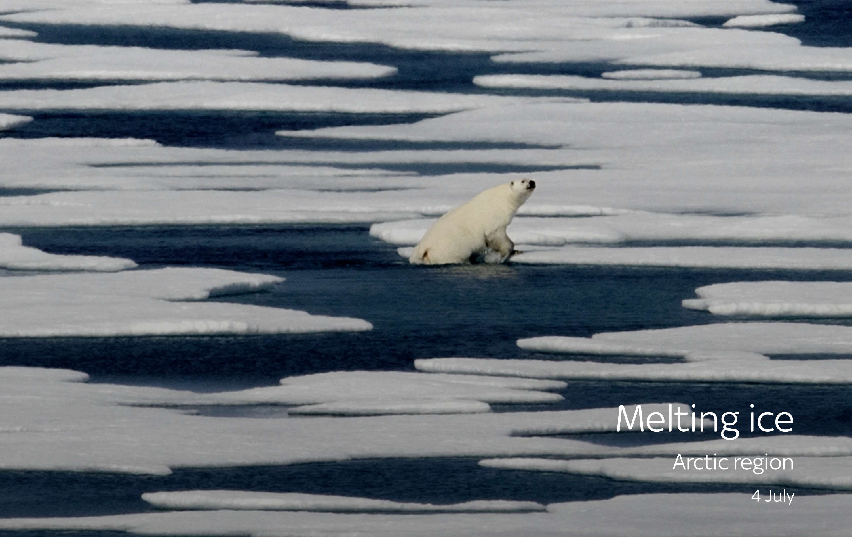
The sea ice in the Arctic region fluctuates every summer, but recent evidence says its average extent over the last decade was at a 1,000-year low.
And, in the first part of July, the ice reached its lowest extent ever recorded for the time of year.
Sebastian Gerland, a sea ice and climate scientist in the Norwegian city of Tromso, was one of the authors of a dire UN climate report - the sixth assessment report by the IPCC - which was described as a "code red" for humanity.
Dr Gerland says it is worrying as sea ice plays a crucial role in cooling down the planet.
The report he helped co-author went further than ever before in apportioning blame for the loss of sea ice, stating: "Human influence is very likely the main driver of the... decrease in Arctic sea ice area."

On 13 July, at 5.15pm, a fire started in California that carried on burning until late October. In doing so, it became the second biggest blaze in the state's history.
Nearly a million acres (so far 3,898 sq km) have been torched and over 1,300 structures destroyed by the Dixie Fire, with almost 2,000 firefighters employed to bring it under control.
The cause is yet to be identified, and it is mostly contained, but numerous experts have accused climate change of creating the conditions in which the fire and others like it in the last few years have raged. In 2020, the August Complex, which burned more than a million acres (4,179 sq km), was the biggest California fire ever.
California is at the sharp end of global warming, with some commentators saying it could face an existential crisis.
Southern California has warmed about three degrees Fahrenheit (1.66C) in the last century, snow is melting earlier in spring and less rain is falling as well, creating the perfect conditions for blazes that rage through the state's forested rural, but widely populated areas.
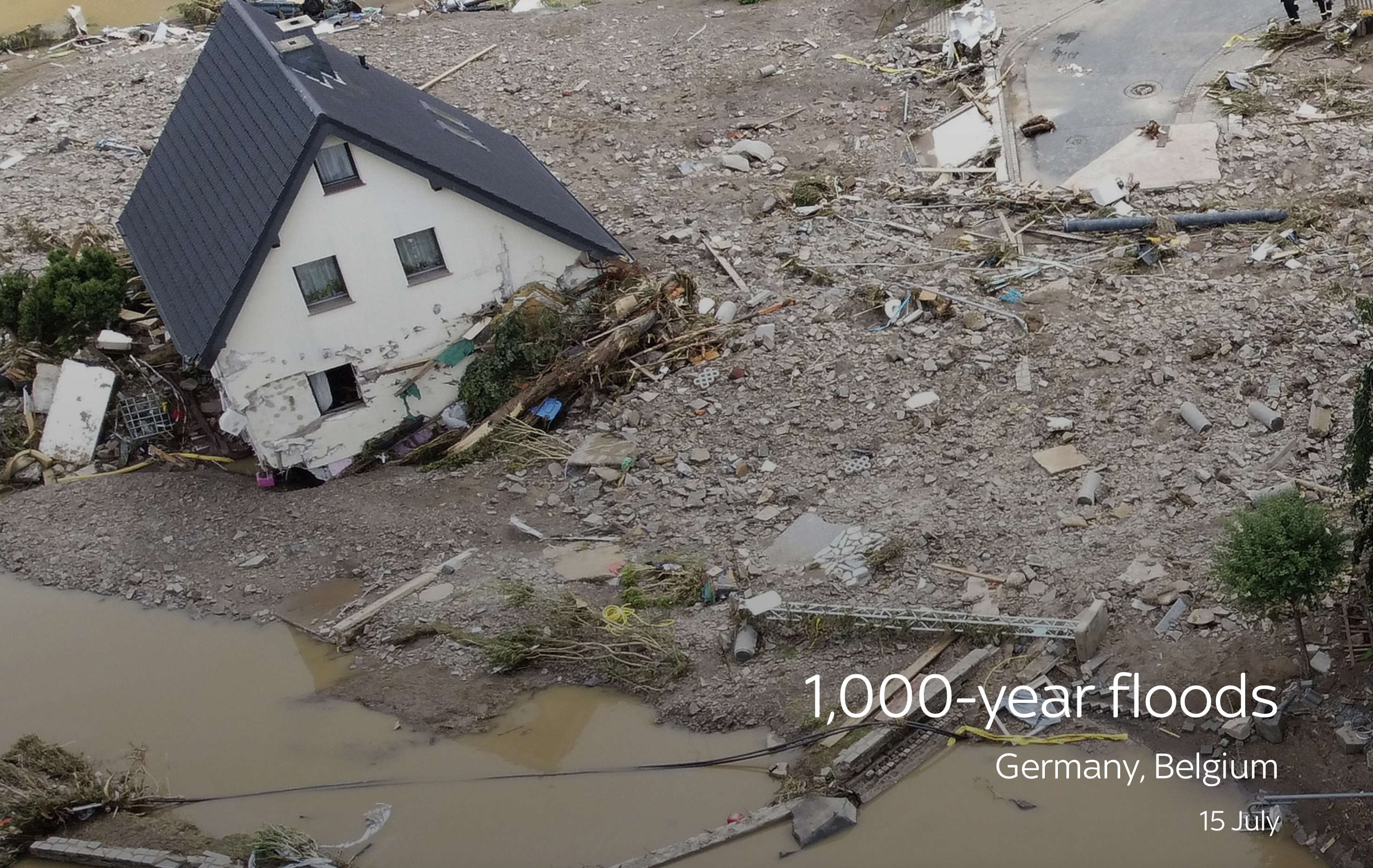
Highly localised heavy rains across northern Europe in July led to a series of floods that crashed through towns and some cities on major rivers and their tributaries.
Some towns in Belgium had more than 21 centimetres (8.5 inches) in 48 hours but the heaviest downpours were in North Rhine-Westphalia and the north of Rhineland-Palatinate in Germany where nearly the same amount fell in a nine-hour period.
It was described as a once in 1,000-year event as 196 died in Germany and 42 in Belgium.
An international team of climate scientists later concluded the rainfall that caused the floods was between 1.2 and 9 times more likely to happen as a result of climate change.
It was among a number of devastating and often record-breaking floods to hit various countries in 2021, many occurring in the height of summer.
Just a few days after the Germany deluge, four cities in the north of China's Henan province were put on the country's highest classification of storm warning - a red alert.
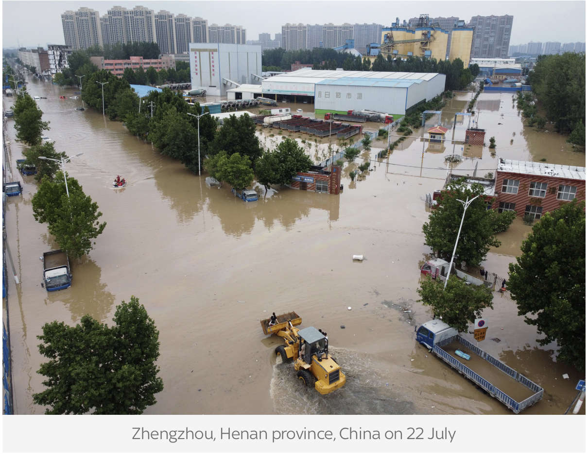
One of them, Xinxiang, was hit with a record 81cm (32ins) of rain, and more than 170,000 people were forced from their homes. More than 300 were killed, including 14 who died when waters flooded the Zhengzhou underground, after around 61cm (24ins) of rain fell in the city.

While the southeast of England had one of its cloudiest summers of recent years, Scotland and Northern Ireland basked in one of their finest summers ever.
Northern Ireland recorded its highest temperature on record with 31.3C (88.3F) on 21 July at Castlederg in Tyrone, in a week that saw records broken three times.
Some parts of Scotland, including the city of Glasgow, where COP 26 was held, had their hottest summer since records began in 1884.
Overall, parts of central Scotland were between 1C (1.8F) and 1.5C (2.7F) warmer than the norm for the summer, with rainfall less than half of what would usually be seen. This compared to places like southwest London and the Isle of Wight which saw more than 170% of the average amount of rain for the period.
It was not all good for Scotland however, with places like Edinburgh suffering severe flash flooding more than once.

Despite cooler temperatures than average in the south of Britain, the Met Office issued its first ever heat warning - a criteria brought in during 2021 to counter the danger from atmospheric heating caused by climate change.

As it turned out, the seventh month was hot almost everywhere, with the US NOAA's National Centers for Environmental Information declaring it the hottest July on record, globally.

August saw record high temperatures across Europe, with the all-time continental record beaten near the Italian city of Syracuse, Sicily, where the mercury reached 48.8C (119.8F) on the 11th.
The figure, which beat the previous European high of 48C (118.4F) recorded in Athens in 1977, was measured by Sicily's weather agency SIAS and is still being verified by the World Meteorological Organisation, but nothing has happened which has so far called it into question. The figure was by default the highest official temperature ever recorded in Italy.
Just a few days later, the all-time record for Spain was also broken in the southern city of Monitor, Andalusia, where the mercury reached 47.4C (117.3F), surpassing the country's previous high, set in the city in 2017, by 0.1C (0.18F).
Conversely, it came in a year when Spain also saw its lowest ever temperature: -35.8C (-32.4F) in the Vega de Liordes, in the mountainous north, on 7 January.
All-time August records were also set in Madrid and Cordoba, reaching 40.7C (105.3F) and 46.9C (116.4F) respectively.
Other records were declared in:
- Turkey - a national record of 49.1C (120.4F) in Cizre on 20 July
- Greece - in Makrakomi, where 46.3C (115.3F) was the highest ever recorded by the official National Observatory of Athens network of hundreds of stations, even though Athens had held the previous European high record, as monitored by a different system
- Tunisia - another national record when the mercury hit 49C (120.2F) in Tunis on the same day as Syracuse hit its high
- Iceland - where an August record of 29.3C (84.7F), in Hallormsstadur, east Iceland, occurred on the 24th
- The Finnish region of Utsjoki, Lapland - where the mercury hit 33.5C (92.3F) on 5 July in Kevo, close to where Santa Claus lives
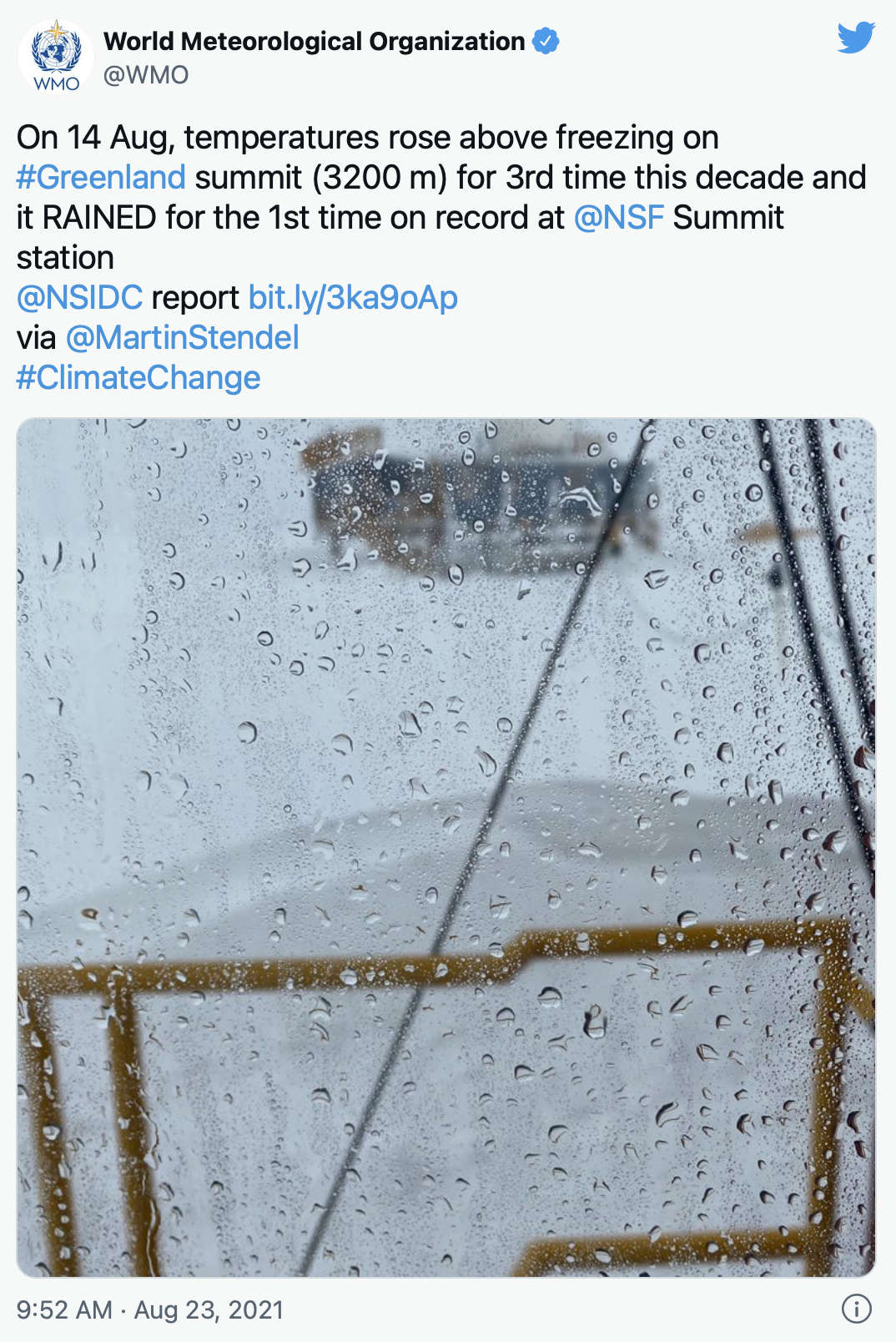
- And the summit of Greenland - which rose above freezing in August for the first time, and where it rained for the first time ever on the 14th, at nearly 10,000ft above sea level and in a country where most of the land is continuously white with snow and ice.
The Sicily announcement came a few months after climate agency Copernicus had declared 2020 as Europe hottest year ever, a record that may yet be surpassed by 2021 after Copernicus said in September that this year had seen the hottest European summer ever.
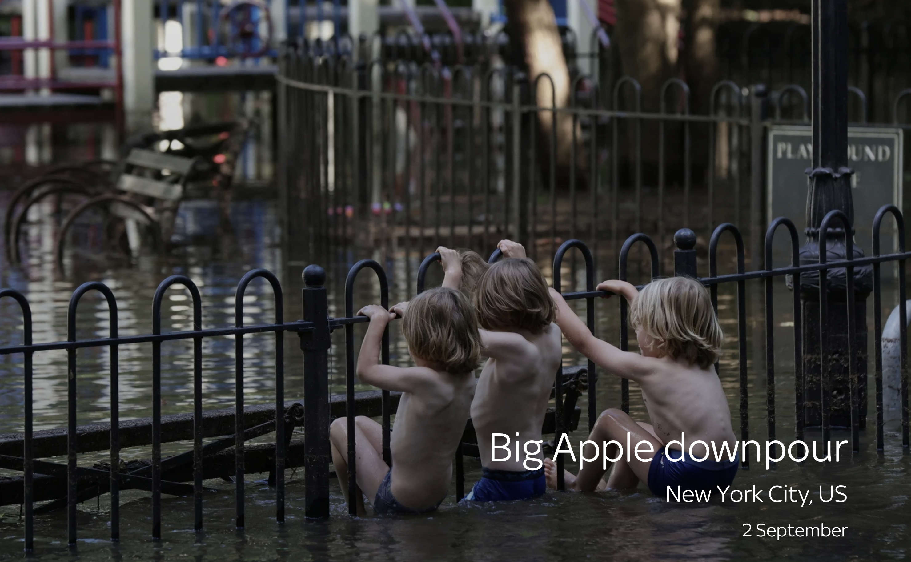
Hurricane Ida left devastation in its wake as it passed across the United States at the start of September.
After it made landfall in Louisiana as a category 4, it worked its way up the Eastern Seaboard dumping huge amounts of rain on the way until it reached the coast again.
Anywhere between 12cm (5ins) and 38cm (15ins) of rain fell as the storm moved north from the Gulf of Mexico, leaving dozens dead.
By the time it reached New York and New Jersey, the National Weather Service declared it a "PARTICULARLY DANGEROUS SITUATION", and ordered people to "SEEK HIGHER GROUND NOW".
By the time it had passed over, rainfall records had been shattered all across the New York City area and its neighbouring conurbations, with several places seeing their highest single-hour rain totals ever, with more than 8cm (3.15ins) falling in the 60 minutes. Newark and LaGuardia, meanwhile, saw their wettest days on record.
October
The wet weather continued into October, when at the end of the month rainfall records were smashed all over California.
Downtown San Francisco, downtown Sacramento, Los Angeles International Airport and a number of hilly or mountainous areas saw unprecedented rain counts, with some areas receiving more than 26.4cm (10.4ins).
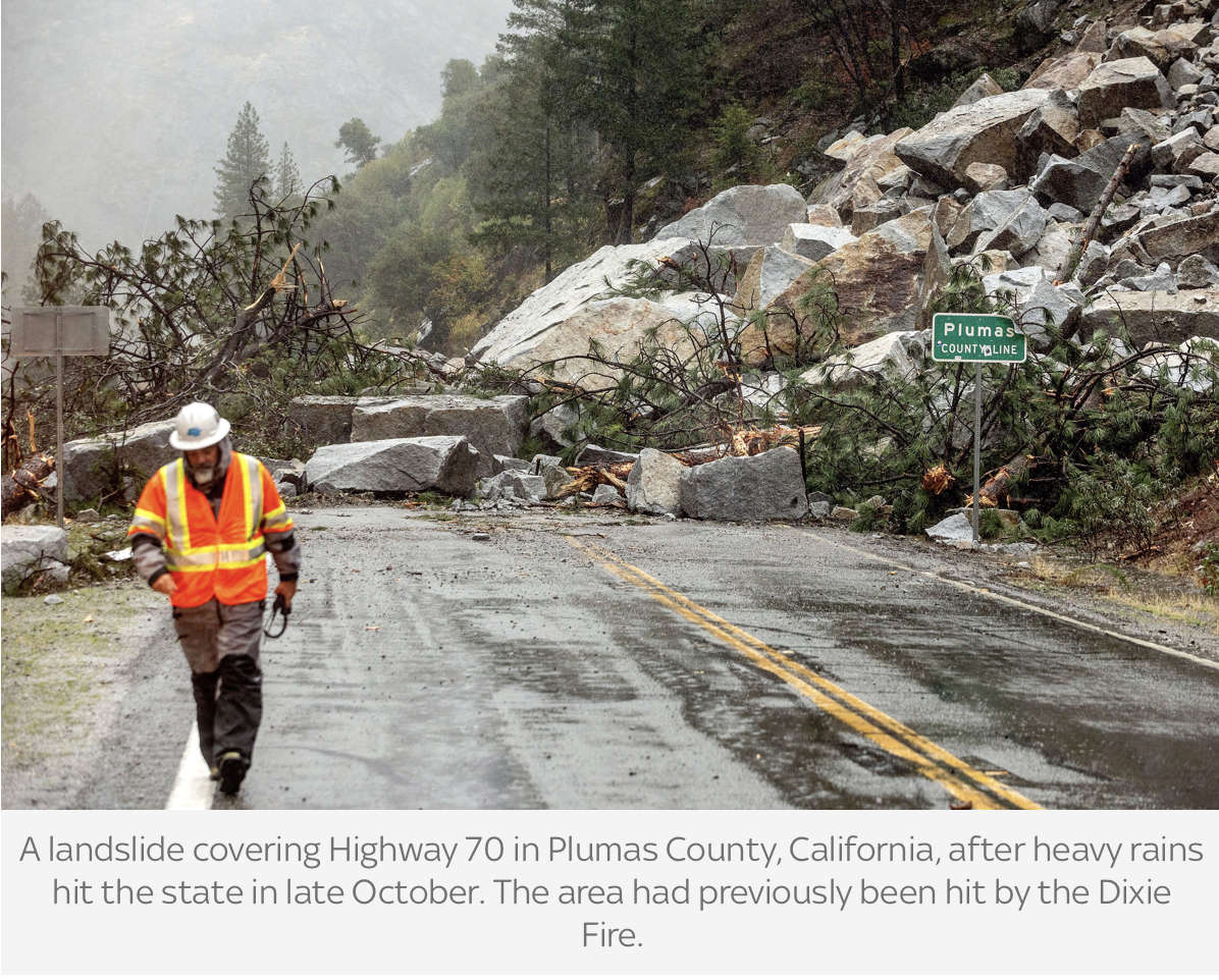
Experts said the storm that caused it - due to something called an atmospheric river - was worse than a 1-in-200 year event.
It came as North America experienced its second hottest October on record, which contributed to the Northern Hemisphere's land masses seeing their hottest October ever.

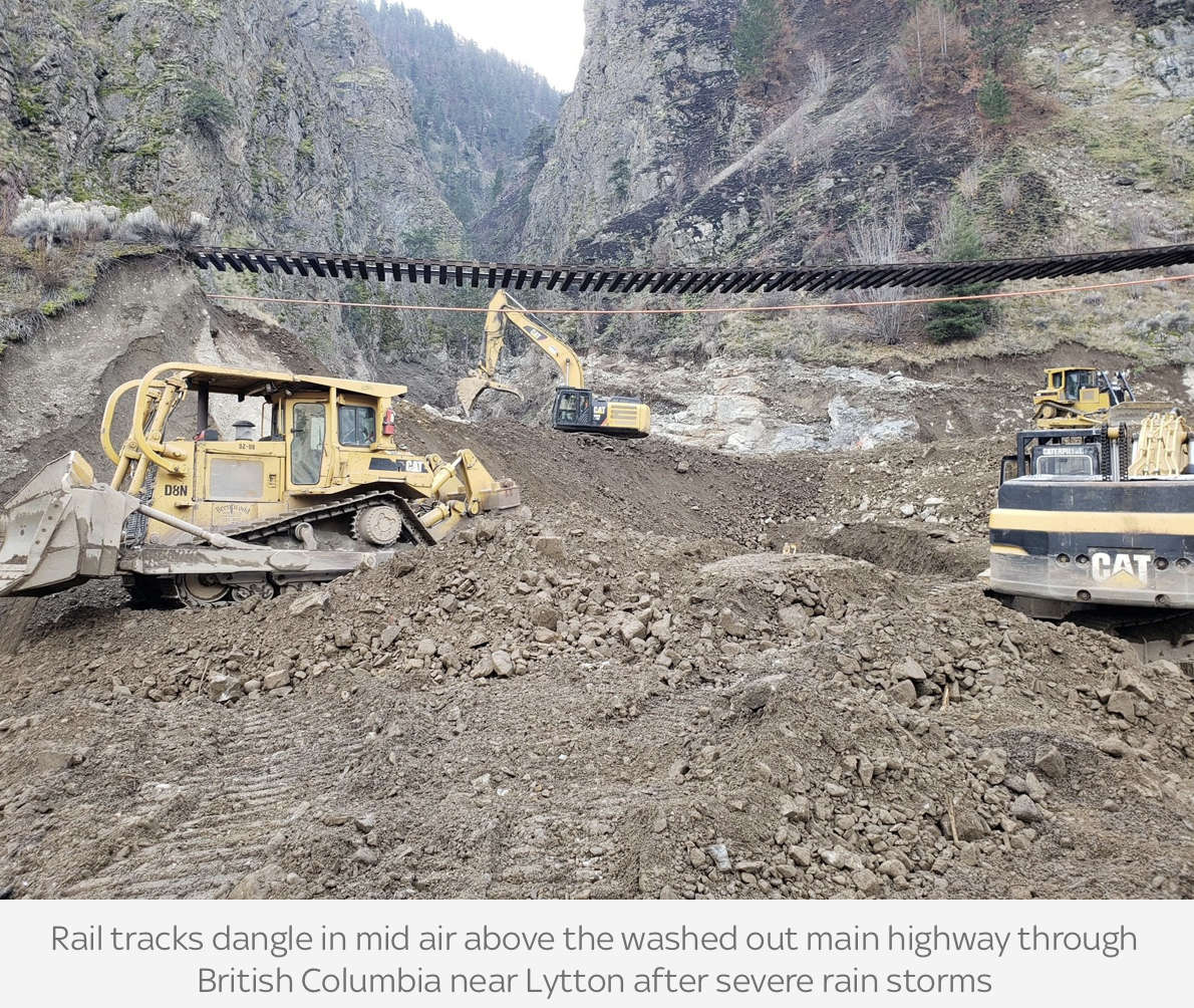
Atmospheric rivers continued to plague North America into November as the Canadian province of British Columbia was also hit, by a month's rain in two days.
The resulting floods and landslides cut road links to Vancouver, left several dead and sparked panic buying from fearful shoppers and concerns about the supply of Christmas trees, as the region is one of the major suppliers for Canada.
In the UK, Cumbria saw its wettest 27 October on record, with the county seeing its third wettest ever six-days - from 26-31 October. During that period, more than 400mm of rain fell on the wettest parts of the Lake District fells, something only previously recorded in 2009, and in 2015, when Storm Desmond resulted in the wettest six English days on record.
In 2021, although there was travel disruption and 40 homes were flooded, the county escaped the kind of flooding seen in earlier years because, the Met Office said, flood defences held.

November
In Australia, the area around Ayers Rock/Uluru saw its wettest November ever as more than 100mm of rain fell in Alice Springs. Large parts of Northern Territory, Queensland, New South Wales and Victoria were under a flood warning due to an "explosion of rain", with some towns seeing up to 46mm (1.8ins) of rain in 30 minutes, at the same time as other parts of the country were warned of the risk of wildfires, due to intense spring heat.
It resulted in one family becoming stuck on a remote outback campsite that turned into a quagmire, leaving them needing an emergency aid drop.
All in all, it was Australia's wettest November since records began in 1900.
The intense rain has led Australian meteorologists to state La Nina weather phenomenon is back for a second year in a row - something not uncommon but that has the potential to cause serious damage, as it did in 2010-12 when Cyclone Yasi hit. On the bright side, it means bushfires of the type seen in 2020 are less likely.
December
Records continued to be broken into December.
Honolulu airport saw a never-seen-before 201mm (7.92ins) of rain on the 6th and Patagonia had a heatwave, with temperatures reaching 37.3C (99.1F) in the northern Patagonian area of El Bolson, in the Andean foothills, on the 7th.
Then, acting perhaps as a portent of what was to come, exceptional unseasonably high temperatures across the US eastern seaboard hit the headlines in December.
As they did so, the movement of air across the States set off a chain reaction that resulted in a series of tornadoes that are among the worst ever seen in winter.
More than 100 were feared to have died across six states when a 250-mile long potentially record-setting twister barrelled across the Middle Mississippi region, tossing aside cars and trees, tearing through factories and knocking down long-standing brick landmarks.
It came the day before max temperature records for 11 December were set or equalled for 28 cities in Ohio, Pennsylvania, West Virginia, New York State, North Carolina and several other states, including in Baltimore, Buffalo, Cleveland, Washington DC, New York City and Philadelphia.
Credits:
Words, digital production and data journalism: Philip Whiteside, international news reporter
Graphics: Pippa Oakley, designer
Pictures: Reuters; Association Press; Met Office; World Food Programme; Press Association; NASA; NOAA; Deutscher Wetterdienst.
 PHOTOS: Ed Sheeran Makes Surprise Visit To Brighton School
 Hove Bar Licence Reviewed After Years Of Complaints
 Record Number Of Wild Swimming Spots Designated As Bathing Sites - With Three More In Sussex
 Council Calls On West Sussex Residents To Consider Fostering
 Meghan, Duchess Of Sussex, Says Nigeria Is 'My Country' On Visit With Prince Harry
 Two Men Wanted In Connection With Hastings Fatal Collision
 M25 Reopens Seven Hours Ahead Of Schedule
 More 'Live' Bus Information Screens To Be Installed In West Sussex
 Rare Bee Found In Lewes
 Event Bookings Go Live For Worthing Festival ‘24